

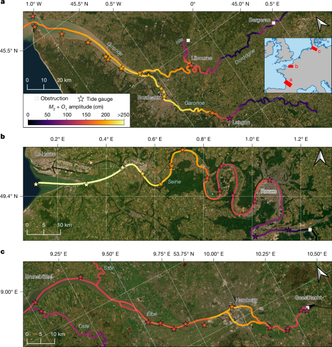
The characteristic tides of coastal rivers influence the distribution of estuarine and wetland habitats1, the extent of fresh drinking water2, carbon and nitrogen cycles3,4, and sediment export to the ocean5. Despite the importance of riverine tides, their range is generally unknown over most of the world’s rivers because the propagation of tidal waves in channels is complex, gauging stations are scarce and conventional nadir altimetry6 has historically been too sparse for use in rivers. Here we use data from the recently launched Surface Water and Ocean Topography (SWOT) satellite to quantify tidal dynamics across 3,172 coastal rivers. Capitalizing on the wide swath coverage of SWOT, we show that over 165,000 river kilometres are influenced by tides. More than 700 million people live near and depend on these coastal transition zones. River size, slope and tidal range at the river mouth influence the extent to which tides propagate within river systems. Natural and artificial obstacles, such as dams, limit tidal propagation in an estimated 16% of all tidal rivers. The tidal dataset opens new possibilities for monitoring and modelling changes in estuarine habitats, fresh drinking water for coastal cities and riverine carbon budgets7 across annual to decadal timescales in response to sea-level rise8, megadrought9, intensifying water extraction and river regulation10. Data from the recently launched SWOT satellite, a wide-swath satellite altimeter, have been used to map tidal dynamics for thousands of coastal rivers and to document the factors controlling the inland extent of tides. The importance of tides is embodied in the origins of the word ‘estuary’, which comes from the Latin word ‘aestuarium’, meaning the place of the tide. Along coastlines, where tides are typically magnified11, they profoundly affect navigation, commerc... [36318 chars]


2026 Copyright © News-Matic.com. All Rights Reserved